
Carte topographique Town of Hammond
Carte interactive
Cliquez sur la carte pour afficher l’altitude.
À propos de cette carte
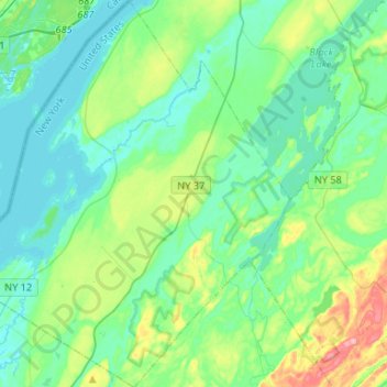
Nom : Carte topographique Town of Hammond, altitude, relief.
Altitude moyenne : 99 m
Altitude minimum : 72 m
Altitude maximum : 190 m
The Village of Hammond is located at 44°26′56″N 75°41′39″W / 44.44889°N 75.69417°W / 44.44889; -75.69417Coordinates: 44°26′56″N 75°41′39″W / 44.44889°N 75.69417°W / 44.44889; -75.69417. The elevation is 358 feet (109 m).
Autres cartes topographiques
Cliquez sur une carte pour visualiser sa topographie, son altitude et son relief.
Cedar Island State Park
United States > New York > Saint Lawrence County > Town of Hammond
Cedar Island State Park, Town of Hammond, Saint Lawrence County, New York, United States
Altitude moyenne : 74 m