
Carte topographique Boston
Carte interactive
Cliquez sur la carte pour afficher l’altitude.
Boston
Boston has an area of 89.63 square miles (232.1 km2)—48.4 square miles (125.4 km2) (54%) of land and 41.2 square miles (106.7 km2) (46%) of water. The city's official elevation, as measured at Logan International Airport, is 19 ft (5.8 m) above sea level. The highest point in Boston is Bellevue Hill at 330 feet (100 m) above sea level, and the lowest point is at sea level. Boston is situated on Boston Harbor, an arm of Massachusetts Bay, itself an arm of the Atlantic Ocean.
À propos de cette carte
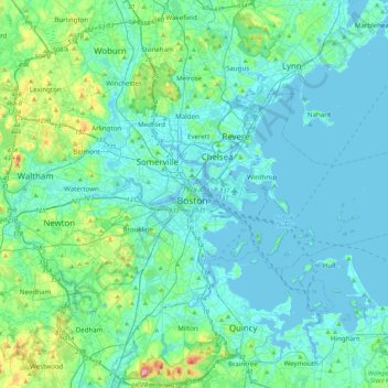
Nom : Carte topographique Boston, altitude, relief.
Lieu : Boston, Suffolk County, Massachusetts, 02102, United States (42.20025 -71.21829 42.52025 -70.89829)
Altitude moyenne : 26 m
Altitude minimum : -5 m
Altitude maximum : 189 m