
Carte topographique Katrineholms kommun
Carte interactive
Cliquez sur la carte pour afficher l’altitude.
À propos de cette carte
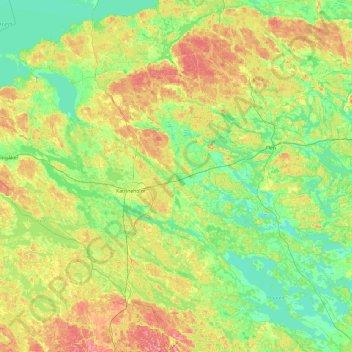
Nom : Carte topographique Katrineholms kommun, altitude, relief.
Lieu : Katrineholms kommun, Comté de Södermanland, Suède (58.76916 15.76242 59.26301 16.62588)
Altitude moyenne : 52 m
Altitude minimum : 16 m
Altitude maximum : 122 m
Autres cartes topographiques
Cliquez sur une carte pour visualiser sa topographie, son altitude et son relief.
Eskilstuna kommun
Eskilstuna kommun, Comté de Södermanland, Suède
Altitude moyenne : 34 m
Trosa kommun
Trosa kommun, Comté de Södermanland, Suède
Altitude moyenne : 10 m
Nyköping
Nyköping, Nyköpings kommun, Comté de Södermanland, 611 33, Suède
Altitude moyenne : 19 m