
Carte topographique Bektemir tumani
Carte interactive
Cliquez sur la carte pour afficher l’altitude.
À propos de cette carte
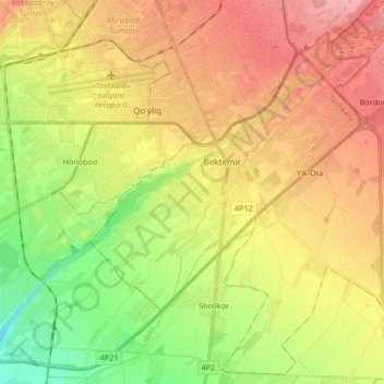
Nom : Carte topographique Bektemir tumani, altitude, relief.
Lieu : Bektemir tumani, Tachkent, 100000, Ouzbékistan (41.20371 69.27612 41.27518 69.39783)
Altitude moyenne : 429 m
Altitude minimum : 389 m
Altitude maximum : 464 m
Autres cartes topographiques
Cliquez sur une carte pour visualiser sa topographie, son altitude et son relief.
Shaykhontohur Tumani
Yashnobod tumani, Tachkent, Shaykhontohur Tumani, 100000, Ouzbékistan
Altitude moyenne : 448 m
Shayhontohur Tumani
Shayhontohur Tumani, Tachkent, 100000, Ouzbékistan
Altitude moyenne : 434 m