Géolocaliser

Cartes topographiques Anugul

Cliquez sur une carte pour visualiser sa topographie, son altitude et son relief.
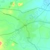
Angul

India > Odisha > Anugul

Angul (also known as Anugul) is a town and a municipality and the headquarters of Angul district in the state of Odisha, India. Angul has an average elevation of 195 m (640 ft) above sea level. The total geographical area of the district is 6232 km2. From the point of view of area, it stands 11th among the 30…

Altitude moyenne : 121 m

Équipez-vous pour votre prochaine aventure :

🔋Chargeur de Piles USB - Alimentez vos appareils à partir d'une batterie externe
🧤Gants de VTT - Protection contre les vibrations et les chutes
🧤Gants de Randonnée Tactiles - Gardez vos mains au chaud tout en utilisant votre GPS
🥤Gourdes de randonnée - Gourdes légères pour hydratation en marche
📏Altimètres & baromètres - Instruments pour surveiller altitude et météo

En tant que Partenaire Amazon, ce site perçoit une commission sur les achats éligibles sans surcoût pour vous.