
Carte topographique Dospat
Carte interactive
Cliquez sur la carte pour afficher l’altitude.
À propos de cette carte
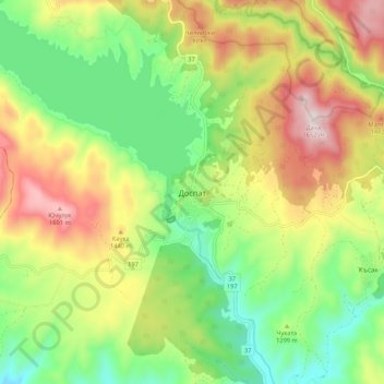
Nom : Carte topographique Dospat, altitude, relief.
Lieu : Dospat, Smolyan, 4831, Bulgaria (41.60836 24.11933 41.68836 24.19933)
Altitude moyenne : 1 304 m
Altitude minimum : 1 058 m
Altitude maximum : 1 647 m
The town was probably founded by Despot Alexius Slav in the 12th or 13th century, from whose title (despot) its name is very likely derived. Dospat Dam is the highest dam in Bulgaria by altitude and, with its 22 km2 of water area, the second largest in capacity. It is fed by the River Dospat. At the bottom of the lake is a former German military airport from the Second World War.
Autres cartes topographiques
Cliquez sur une carte pour visualiser sa topographie, son altitude et son relief.