
Carte topographique Roundwood
Carte interactive
Cliquez sur la carte pour afficher l’altitude.
À propos de cette carte
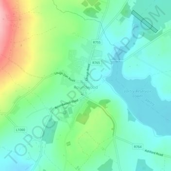
Nom : Carte topographique Roundwood, altitude, relief.
Altitude moyenne : 242 m
Altitude minimum : 203 m
Altitude maximum : 342 m
Autres cartes topographiques
Cliquez sur une carte pour visualiser sa topographie, son altitude et son relief.
Rathmichael (Bray) ED
Rathmichael (Bray) ED, The Municipal District of Bray, County Wicklow, Leinster, Ireland
Altitude moyenne : 36 m
Aughrim
Aughrim, The Municipal District of Arklow, County Wicklow, Leinster, Y14 HT72, Ireland
Altitude moyenne : 123 m
Toberbeg
Toberbeg, Dunlavin ED, The Municipal District of Baltinglass, County Wicklow, Leinster, Ireland
Altitude moyenne : 207 m