
Carte topographique Mauloff
Cliquez sur la carte pour afficher l’altitude.
À propos de cette carte
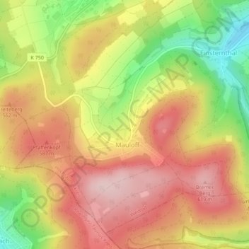
Nom : Carte topographique Mauloff, altitude, relief.
Lieu : Mauloff, Weilrod, Hochtaunuskreis, Hesse, Germany (50.27433 8.37872 50.29779 8.41275)
Altitude moyenne : 524 m
Altitude minimum : 377 m
Altitude maximum : 630 m
Autres cartes topographiques
Cliquez sur une carte pour visualiser sa topographie, son altitude et son relief.
Großer Feldberg
Germany > Hesse > Hochtaunuskreis > Schmitten im Taunus
The Großer Feldberg ('Great Field Mountain') is, at a height of 879.5 metres, the highest elevation of the Taunus mountains, and of the entire Rhenish Massif. It is situated in the Hochtaunuskreis district in Hesse, Germany.
Altitude moyenne : 716 m
Saubach und Niedgesbach bei Schmitten
Germany > Hesse > Hochtaunuskreis > Finsternthal
Altitude moyenne : 549 m