
Carte topographique Franklin Township
Carte interactive
Cliquez sur la carte pour afficher l’altitude.
À propos de cette carte
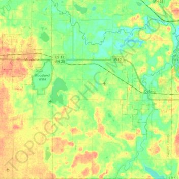
Nom : Carte topographique Franklin Township, altitude, relief.
Lieu : Franklin Township, Wright County, Minnesota, United States (44.97767 -93.89086 45.10833 -93.75858)
Altitude moyenne : 290 m
Altitude minimum : 271 m
Altitude maximum : 312 m
Autres cartes topographiques
Cliquez sur une carte pour visualiser sa topographie, son altitude et son relief.
Chatham Township
United States > Minnesota > Wright County
Chatham Township, Wright County, Minnesota, United States
Altitude moyenne : 302 m