
Carte topographique Chatham Township
Carte interactive
Cliquez sur la carte pour afficher l’altitude.
À propos de cette carte
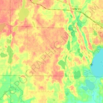
Nom : Carte topographique Chatham Township, altitude, relief.
Lieu : Chatham Township, Wright County, Minnesota, United States (45.15110 -94.01273 45.19578 -93.88359)
Altitude moyenne : 302 m
Altitude minimum : 273 m
Altitude maximum : 325 m
Autres cartes topographiques
Cliquez sur une carte pour visualiser sa topographie, son altitude et son relief.
Franklin Township
United States > Minnesota > Wright County
Franklin Township, Wright County, Minnesota, United States
Altitude moyenne : 290 m