
Carte topographique Streda nad Bodrogom
Carte interactive
Cliquez sur la carte pour afficher l’altitude.
À propos de cette carte
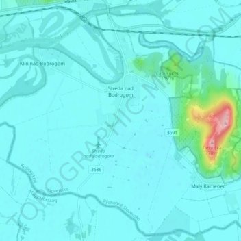
Nom : Carte topographique Streda nad Bodrogom, altitude, relief.
Altitude moyenne : 106 m
Altitude minimum : 88 m
Altitude maximum : 272 m
The village has the lowest altitude (94 metres (308 ft) above sea level) in Slovakia.
Autres cartes topographiques
Cliquez sur une carte pour visualiser sa topographie, son altitude et son relief.
Bačka
Slovakia > Region of Košice > District of Trebišov
Bačka, District of Trebišov, Region of Košice, Eastern Slovakia, Slovakia
Altitude moyenne : 101 m
Bara
Slovakia > Region of Košice > District of Trebišov
Bara, District of Trebišov, Region of Košice, Eastern Slovakia, Slovakia
Altitude moyenne : 160 m
Boťany
Slovakia > Region of Košice > District of Trebišov
Boťany, District of Trebišov, Region of Košice, Eastern Slovakia, 076 43, Slovakia
Altitude moyenne : 101 m