
Carte topographique Ilup
Carte interactive
Cliquez sur la carte pour afficher l’altitude.
À propos de cette carte
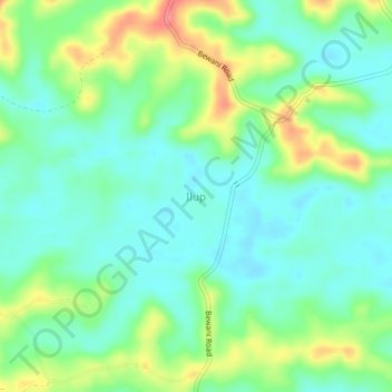
Nom : Carte topographique Ilup, altitude, relief.
Lieu : Ilup, Sandaun, Momase Region, Papua New Guinea (-2.92249 141.19855 -2.88249 141.23855)
Altitude moyenne : 85 m
Altitude minimum : 60 m
Altitude maximum : 137 m
Autres cartes topographiques
Cliquez sur une carte pour visualiser sa topographie, son altitude et son relief.
Vanimo District
Vanimo District, Sandaun, Momase Region, Papua New Guinea
Altitude moyenne : 185 m
Anguganak
Anguganak, Sandaun, Momase Region, Papua New Guinea
Altitude moyenne : 331 m
Aitape District
Papua New Guinea > Sandaun > Aitape District
Aitape District, Sandaun, Momase Region, Papua New Guinea
Altitude moyenne : 150 m