
Carte topographique Papplewick CP
Cliquez sur la carte pour afficher l’altitude.
À propos de cette carte
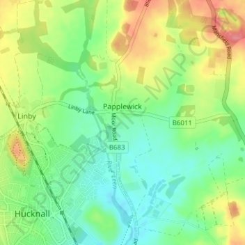
Nom : Carte topographique Papplewick CP, altitude, relief.
Altitude moyenne : 87 m
Altitude minimum : 57 m
Altitude maximum : 137 m
Autres cartes topographiques
Cliquez sur une carte pour visualiser sa topographie, son altitude et son relief.
Arnold
United Kingdom > England > Nottinghamshire > Gedling
The local topography suggests that Arnold can never have been a haunt of eagles, because they inhabit areas of rocky outcrops, which have formed cliffs: the nearest such location is Creswell Crags, some 20 miles (32 km) north-west as the eagle flies. However, the fish-eating white-tailed eagle (also known as…
Altitude moyenne : 81 m
Gedling Country Park
United Kingdom > England > Nottinghamshire > Gedling > Carlton
Altitude moyenne : 80 m
Lambley Lane Recreation Ground (North)
United Kingdom > England > Nottinghamshire > Gedling > Carlton
Altitude moyenne : 73 m
Colwick Country Park
United Kingdom > England > Nottinghamshire > Gedling > Carlton > Colwick
Altitude moyenne : 32 m