
Carte topographique Chan Chan
Cliquez sur la carte pour afficher l’altitude.
À propos de cette carte
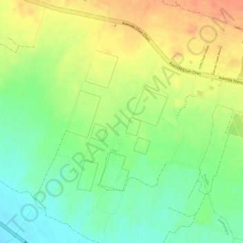
Nom : Carte topographique Chan Chan, altitude, relief.
Lieu : Chan Chan, Huanchaco, Trujillo, La Libertad, Perú (-8.12087 -79.08649 -8.09112 -79.06353)
Altitude moyenne : 27 m
Altitude minimum : 0 m
Altitude maximum : 51 m
Autres cartes topographiques
Cliquez sur une carte pour visualiser sa topographie, son altitude et son relief.