
Carte topographique Benito Juárez Segundo (La Raya)
Carte interactive
Cliquez sur la carte pour afficher l’altitude.
À propos de cette carte
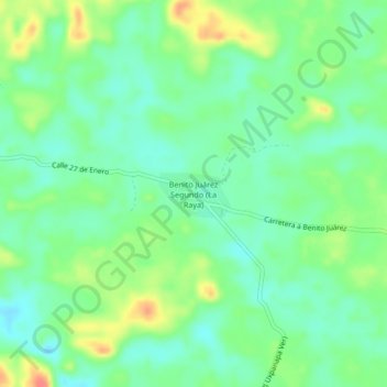
Nom : Carte topographique Benito Juárez Segundo (La Raya), altitude, relief.
Lieu : Benito Juárez Segundo (La Raya), Uxpanapa, Veracruz, México (17.29639 -94.51861 17.33639 -94.47861)
Altitude moyenne : 87 m
Altitude minimum : 67 m
Altitude maximum : 124 m
Autres cartes topographiques
Cliquez sur une carte pour visualiser sa topographie, son altitude et son relief.
Poblado Cinco
Poblado Cinco, Uxpanapa, Veracruz, México
Altitude moyenne : 97 m
La Chinantla
La Chinantla, Uxpanapa, Veracruz, México
Altitude moyenne : 117 m
Isthmus of Tehuantepec
Isthmus of Tehuantepec, Uxpanapa, Veracruz, México
Altitude moyenne : 277 m