
Carte topographique Schloss Neuhaus
Carte interactive
Cliquez sur la carte pour afficher l’altitude.
À propos de cette carte
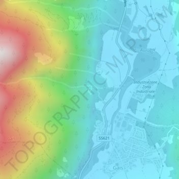
Nom : Carte topographique Schloss Neuhaus, altitude, relief.
Altitude moyenne : 1 115 m
Altitude minimum : 826 m
Altitude maximum : 1 961 m
Autres cartes topographiques
Cliquez sur une carte pour visualiser sa topographie, son altitude et son relief.
Blossberg
Italien > Trentino-Südtirol > Bozen > Gais
Blossberg, Gais, Pustertal, Bozen, Trentino-Südtirol, 39032, Italien
Altitude moyenne : 2 230 m