Géolocaliser

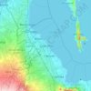
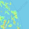
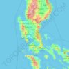
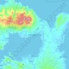
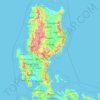
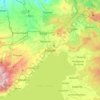
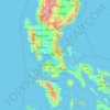
Carte topographique Isabela

Cliquez sur la carte pour afficher l’altitude.

Isabela

The province is divided into three physiographic areas. The eastern area, straddled by the Sierra Madre mountain range, is rugged and thickly forested. A substantial portion is uncharted. These unexplored hinterlands are home to a rich variety of flora and fauna, and some are under government reservations. It is home to one of the world's largest remaining low-altitude rainforests, with numerous unknown endemic species of flora and fauna and biological diversity in the protected area known as the Northern Sierra Madre Natural Park. Isabela has 600,000 hectares (1,500,000 acres) of Cagayan Valley’s 900,000 hectares (2,200,000 acres) of forest cover.

Wikipedia (CC-BY-SA 3.0)

À propos de cette carte

Nom : Carte topographique Isabela, altitude, relief.

Lieu : Isabela, Cagayan Valley, Philippines (16.39443 121.33589 17.56891 122.66939)

Altitude moyenne : 227 m

Altitude minimum : -1 m

Altitude maximum : 1 796 m

Autres cartes topographiques

Cliquez sur une carte pour visualiser sa topographie, son altitude et son relief.
Baguio

Philippines

In 1903, Filipinos, Japanese and Chinese workers were hired to build Kennon Road, the first road directly connecting Baguio with the lowlands of La Union and Pangasinan. Before this, the only road to Benguet was Naguilian Road, and it was largely a horse trail at higher elevations. Camp John Hay was…

Altitude moyenne : 881 m
Cebu City

Philippines > Cebu > Cebu City

Altitude moyenne : 140 m

Quezon City

Philippines

Founded as a pueblo by Saint Pedro Bautista in 1590, San Francisco del Monte may be considered Quezon City's oldest district. The original land area of the old town of San Francisco del Monte was approximately2.5 square kilometres (1.0 sq mi) and covered parts of what is currently known as Project 7 and 8 and…

Altitude moyenne : 57 m
Upper Agno River Basin

Philippines > Benguet

Altitude moyenne : 1 289 m

Bohol

Philippines

Altitude moyenne : 116 m

Mount Pulag

Philippines > Benguet

At lower elevations, Mount Pulag has a mossy forest full of ferns, lichens, and moss.

Altitude moyenne : 2 572 m
Tayabas

Philippines > Quezon

Altitude moyenne : 246 m

Bacoor

Philippines > Cavite

Altitude moyenne : 18 m

Meycauayan

Philippines > Bulacan

Altitude moyenne : 27 m

Parañaque

Philippines

Altitude moyenne : 14 m

Candaba

Philippines

Altitude moyenne : 6 m

Lingayen

Philippines > Pangasinan

Altitude moyenne : 4 m

Santa Rosa

Philippines > Laguna > Santa Rosa

Altitude moyenne : 65 m

Balingasag

Philippines > Misamis Oriental

Altitude moyenne : 30 m

Echague

Philippines > Isabela

Altitude moyenne : 71 m

Dagupan

Philippines > Pangasinan

Altitude moyenne : 12 m

El Nido

Philippines > Palawan

Altitude moyenne : 33 m

Tarlac City

Philippines > Tarlac

Altitude moyenne : 56 m

Davao Gulf

Philippines

Altitude moyenne : 0 m

Albay

Philippines

Altitude moyenne : 48 m

Alabel

Philippines > Sarangani

Altitude moyenne : 63 m

Camiguin Island

Philippines > Camiguin

Altitude moyenne : 51 m

Tucdao

Philippines > Biliran

Altitude moyenne : 55 m

Monkayo

Philippines > Davao de Oro

Altitude moyenne : 86 m

Bambang

Philippines > Nueva Vizcaya

Altitude moyenne : 376 m

Botolan

Philippines > Zambales

Altitude moyenne : 22 m

Jose Panganiban

Philippines > Camarines Norte

Altitude moyenne : 41 m

Kabayan

Philippines > Benguet

Altitude moyenne : 1 578 m

Nueva Ecija

Philippines

Altitude moyenne : 112 m

Guiguinto

Philippines > Bulacan

Altitude moyenne : 5 m

Valencia

Philippines > Negros Oriental > Valencia

Valencia occupies an area of 14,749 hectares (36,450 acres), 35% of which are classified as plains. The town is 65% mountainous, with elevation averaging from 200 to 500 metres (660 to 1,640 ft) above sea level, with the top of Mount Talinis at an elevation of 1,903 metres (6,243 ft) along the municipal…

Altitude moyenne : 250 m
Panglao Island

Philippines > Bohol

Altitude moyenne : 47 m

San Ildefonso

Philippines > Bulacan

Altitude moyenne : 17 m

Pili

Philippines > Camarines Sur

Altitude moyenne : 31 m

Alicia

Philippines > Isabela

Altitude moyenne : 67 m

Ramon

Philippines > Isabela

Altitude moyenne : 100 m

Valencia

Philippines > Bukidnon

The city's topography is characterized as flat to undulating hills with extensive plateaus and mountainous areas and cliffs on both eastern and western portions bounding the municipality of San Fernando on the east and the municipality of Talakag on the west. Its highest point is Mount Kalatungan in the…

Altitude moyenne : 566 m
Initao

Philippines > Misamis Oriental

Altitude moyenne : 42 m

Camalig

Philippines > Albay

Altitude moyenne : 191 m

Pagadian

Philippines > Zamboanga del Sur

About 45% of the total city area is steeply sloping terrain of hills and mountains on the northwestern portion that covers an estimated 15,090 hectares. Mt. Sugarloaf (1,376 m.), Mt. Pinukis (1,213 m.), and Mt. Palpalan (650 m.) are the three notable mountain peaks. Areas in the direct north and central part,…

Altitude moyenne : 169 m
San Fernando

Philippines > Pampanga

Altitude moyenne : 24 m

Aurora Hill North Central

Philippines

Altitude moyenne : 1 479 m

Santa Cruz

Philippines > Tarlac > Tarlac City

Altitude moyenne : 37 m

Samar

Philippines

Altitude moyenne : 38 m

Bulacan

Philippines

Altitude moyenne : 105 m

Iligan

Philippines

Altitude moyenne : 229 m

Cavinti

Philippines > Laguna > Cavinti

Altitude moyenne : 250 m

Nabua

Philippines > Camarines Sur > Nabua

Nabua has about 8,803.0600 hectares or 99.42% very low elevation or less than 100 meters elevation and remaining 51.3593 hectares or 0.58% of low elevation or between 100 and 300 meters elevation. Its slope covers about 7,927.3616 hectares or 89.53% which are level to nearly level (0-3%) while the remaining…

Altitude moyenne : 14 m
Olongapo

Philippines > Zambales > Olongapo

Altitude moyenne : 194 m

Sorsogon City

Philippines > Sorsogon

Sorsogon City covers a land area of 31,292 hectares (120.82 sq mi). It is at the southernmost tip of the Bicol Peninsula and of Luzon Island. The city is bounded by Castilla in the west, Manito in the northwest, Albay Gulf in the north, Prieto Diaz in the east, Gubat in the southeast, Casiguran in the…

Altitude moyenne : 90 m
Mandaluyong

Philippines

Another claims that the Spaniards named the place based on the report of a navigator named Acapulco, who saw the rolling hills frequently being lashed at by daluyong (“big waves from the sea”). This seems to confirm traditional pre-Hispanic stories that giant waves from the sea would meet the adjoining…

Altitude moyenne : 33 m

Marikina

Philippines

Altitude moyenne : 80 m

Cadlan

Philippines > Camarines Sur > Pili

Altitude moyenne : 40 m

Basac

Philippines > Bukidnon > Lantapan

Altitude moyenne : 1 176 m

Tiwi

Philippines > Albay

Altitude moyenne : 44 m

Dalig

Philippines > Rizal > Teresa

Altitude moyenne : 73 m

Catmon

Philippines > Bulacan > Santa Maria

Altitude moyenne : 31 m

Loboc River

Philippines > Bohol > Loboc > Camisan

Altitude moyenne : 70 m

Banjo Laurel

Philippines > Batangas > Tanauan

Altitude moyenne : 167 m

Carmen

Philippines > Cagayan de Oro

Altitude moyenne : 32 m

Nueva Vizcaya

Philippines

Altitude moyenne : 107 m

Lebak

Philippines > Sultan Kudarat

Altitude moyenne : 19 m

Quirino

Philippines

Altitude moyenne : 108 m

Tatala

Philippines > Rizal > Binangonan

Altitude moyenne : 52 m

Pundaquit

Philippines > Zambales > San Antonio

Altitude moyenne : 79 m

Romblon Island

Philippines > Romblon

Altitude moyenne : 43 m

Cabatuan

Philippines > Iloilo

Altitude moyenne : 74 m

Murcia

Philippines > Negros Occidental > Murcia

Altitude moyenne : 126 m

Tanay

Philippines > Rizal

Altitude moyenne : 32 m

Esperanza Ibaba

Philippines > Cavite > Alfonso

Altitude moyenne : 459 m

Montalban

Philippines > Rizal > Rodriguez

Rodriguez is generally very rough in topography, with 83% of its total land area composed of upland areas, hills and mountain ranges. The remaining 17% low-lying terrain and rolling lands are found at the south-western portion of the municipality, along with the northern portions of the Municipality of San…

Altitude moyenne : 99 m
Guimba

Philippines > Nueva Ecija

Altitude moyenne : 35 m

Palo

Philippines > Leyte > Palo

Altitude moyenne : 11 m

Marawi

Philippines > Lanao del Sur

Marawi is located upon the shores of Lake Lanao.[6] It is primarily inhabited by the Maranao people. The city is also called the "summer capital of the south" due to its higher elevation and cooler climate,[7] a nickname it shares with Malaybalay.[8][better source needed]

Altitude moyenne : 707 m
San Juan

Philippines

"San Juan" is a contraction of the city's traditional name of "San Juan del Monte" (lit. 'Saint John of the Mountain'). As with numerous other places in the Philippines, the name combines a patron saint and a toponym; in this case Saint John the Baptist with the locale's hilly terrain and relatively higher…

Altitude moyenne : 35 m

Kalanganan 1

Philippines > Cotabato City

Altitude moyenne : 5 m

Culaba

Philippines > Biliran

Altitude moyenne : 124 m

Bulan

Philippines > Sorsogon

Altitude moyenne : 5 m

Datu Montawal

Philippines > Maguindanao del Sur

Altitude moyenne : 14 m

Duka

Philippines > Misamis Oriental

Altitude moyenne : 51 m

Jiabong

Philippines > Samar

Altitude moyenne : 48 m

Mondragon

Philippines > Northern Samar

Altitude moyenne : 13 m

Tanawan

Philippines > Camarines Norte

Altitude moyenne : 122 m

Surigao del Sur

Philippines

Altitude moyenne : 274 m

Culiat Creek

Philippines > Quezon City

Altitude moyenne : 44 m

Catambungan

Philippines

Altitude moyenne : 5 m

Buenavista

Philippines

Altitude moyenne : 112 m

Tarlac

Philippines

Altitude moyenne : 109 m

Zone IV

Philippines

Altitude moyenne : 4 m

Bontoc

Philippines > Southern Leyte

Altitude moyenne : 37 m

Madridejos

Philippines > Cebu

Altitude moyenne : 2 m

Magat River

Philippines

Altitude moyenne : 46 m

Las Piñas

Philippines

Altitude moyenne : 14 m

Dalaguete

Philippines > Cebu

Altitude moyenne : 70 m

Rizal

Philippines

Altitude moyenne : 95 m

Biñan

Philippines > Laguna > Biñan > Biñan

Altitude moyenne : 101 m

Tabaco

Philippines > Albay

The City of Tabaco is located on the eastern coast of Albay province with an area of 117.14 km2 (45.23 sq mi). The terrain in the poblacion or town center of Tabaco is generally flat with the highest elevation at around 5 m (16 ft). The northwestern portion reaches 400 m (1,300 ft) above sea level. The city's…

Altitude moyenne : 182 m

Équipez-vous pour votre prochaine aventure :

🧭Orientation carte & boussole - Matériel pour navigation traditionnelle
🧢Casquette avec Protège-Nuque - Protection solaire optimale pour les terrains découverts
🕶️Lunettes Glacier Catégorie 4 - Protection maximale contre la réverbération en haute montagne
📏Altimètres & baromètres - Instruments pour surveiller altitude et météo
🦵Genouillère de Maintien - Soutien articulaires pour les descentes à fort dénivelé

En tant que Partenaire Amazon, ce site perçoit une commission sur les achats éligibles sans surcoût pour vous.