
Carte topographique Sisak
Carte interactive
Cliquez sur la carte pour afficher l’altitude.
À propos de cette carte
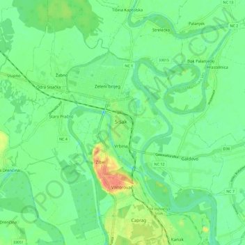
Nom : Carte topographique Sisak, altitude, relief.
Lieu : Sisak, Grad Sisak, Sisak-Moslavina County, 44000, Croatia (45.44883 16.33548 45.52883 16.41548)
Altitude moyenne : 98 m
Altitude minimum : 83 m
Altitude maximum : 127 m
Sisak (Croatian: ; Hungarian: Sziszek ; also known by other alternative names) is a city and episcopal see in central Croatia, located at the confluence of the Kupa, Sava and Odra rivers, 57 km (35 mi) southeast of the Croatian capital Zagreb, and is usually considered to be where the Posavina (Sava basin) begins, with an elevation of 99 m. The city's total population in 2011 was 47,768 of which 33,322 live in the urban settlement (naselje).
Autres cartes topographiques
Cliquez sur une carte pour visualiser sa topographie, son altitude et son relief.