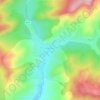
Carte topographique Dobrota
Cliquez sur la carte pour afficher l’altitude.
À propos de cette carte

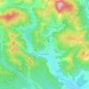
Nom : Carte topographique Dobrota, altitude, relief.
Lieu : Dobrota, Gornet-Cricov, Prahova, 107292, Romania (45.08022 26.26325 45.12022 26.30325)
Altitude moyenne : 310 m
Altitude minimum : 161 m
Altitude maximum : 492 m
Autres cartes topographiques
Cliquez sur une carte pour visualiser sa topographie, son altitude et son relief.
Sinaia
Sinaia is about 65 kilometres (40 miles) northwest of Ploiești and 48 kilometres (30 miles) south of Brașov, in a mountainous area on the Prahova River valley, just east of the Bucegi Mountains. The town's altitude varies between 767 to 860 metres (2,516 to 2,822 feet) above sea level.
Altitude moyenne : 1 249 m
Ploiești
Despite sustaining heavy damage from the 1940 Vrancea earthquake, Ploiești was rebuilt and served as the primary source of petroleum for Nazi Germany during World War II. Consequently, the Allies targeted the city heavily during the oil campaign of World War II. Early air operations included the small-scale…
Altitude moyenne : 158 m
Ploiești
The city lies on the Wallachian Plain, having an average altitude of 150 m (490 ft). The surrounding landscape is influenced by its position around the Prahova River, whose stream bed lies 25 km (16 mi) to the west. The Teleajen River passes through the city while the Dâmbu River passes through the…
Altitude moyenne : 158 m
Comarnic
The town is situated in the southern foothills of the Carpathian Mountains, close to the interface between the Southern Carpathians and the Eastern Carpathians, at an altitude of 555 m (1,821 ft). It lies towards the southern end of the Prahova Valley, along the Prahova River, in the main on the left bank, but…
Altitude moyenne : 885 m

Bușteni
Bușteni (Romanian pronunciation: [buʃˈtenʲ]) is a small mountain town in the north of Prahova County, Muntenia, Romania. It is located in the Prahova Valley, at the bottom of the Bucegi Mountains, that have a maximum altitude of 2,505 m (8,219 ft). Its name literally means tree-logs in Romanian. One…
Altitude moyenne : 1 419 m


Ploiești
The city lies on the Wallachian Plain, having an average altitude of 150 m (490 ft). The surrounding landscape is influenced by its position around the Prahova River, whose stream bed lies 25 km (16 mi) to the west. The Teleajen River passes through the city while the Dâmbu River passes through the…
Altitude moyenne : 158 m
Ploiești
The city lies on the Wallachian Plain, having an average altitude of 150 m (490 ft). The surrounding landscape is influenced by its position around the Prahova River, whose stream bed lies 25 km (16 mi) to the west. The Teleajen River passes through the city while the Dâmbu River passes through the…
Altitude moyenne : 158 m












Sinaia
Sinaia is about 65 kilometres (40 miles) northwest of Ploiești and 48 kilometres (30 miles) south of Brașov, in a mountainous area on the Prahova River valley, just east of the Bucegi Mountains. The town's altitude varies between 767 to 860 metres (2,516 to 2,822 feet) above sea level.
Altitude moyenne : 1 249 m