
Carte topographique Kayonza Sub-County
Carte interactive
Cliquez sur la carte pour afficher l’altitude.
À propos de cette carte
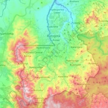
Nom : Carte topographique Kayonza Sub-County, altitude, relief.
Lieu : Kayonza Sub-County, Kanungu, Western Region, Ouganda (-0.99212 29.58189 -0.83394 29.70331)
Altitude moyenne : 1 386 m
Altitude minimum : 1 045 m
Altitude maximum : 1 913 m
Autres cartes topographiques
Cliquez sur une carte pour visualiser sa topographie, son altitude et son relief.
Nyaka Sub-County
Nyaka Sub-County, Kanungu, Western Region, Ouganda
Altitude moyenne : 1 017 m
Mpungu Sub-County
Mpungu Sub-County, Kanungu, Western Region, Ouganda
Altitude moyenne : 1 716 m
Kanungu Town Council
Kanungu Town Council, Kanungu, Western Region, Ouganda
Altitude moyenne : 1 639 m