Géolocaliser

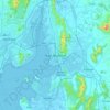
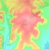
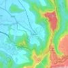
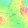
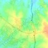
Carte topographique Alibag

Cliquez sur la carte pour afficher l’altitude.

À propos de cette carte

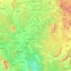
Nom : Carte topographique Alibag, altitude, relief.

Lieu : Alibag, Raigad, Maharashtra, India (18.48586 72.85554 18.82898 73.07345)

Altitude moyenne : 40 m

Altitude minimum : -4 m

Altitude maximum : 537 m

Autres cartes topographiques

Cliquez sur une carte pour visualiser sa topographie, son altitude et son relief.
Pune

India > Maharashtra > Pune City Subdistrict

Altitude moyenne : 641 m

Ajinkyatara Fort

India > Maharashtra > Satara > Satara

Ajinkyatara Fort, also known as the "Fort of the Sapta-Rishi," is a historical hill fort located on Ajinkyatara Mountain, one of the seven mountains surrounding the city of Satara in the Sahyadri Mountains of Maharashtra, India. Situated at an altitude of 3,300 feet, the fort overlooks Satara City and is…

Altitude moyenne : 764 m
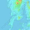
Mumbai

India > Maharashtra

Mumbai lies at the mouth of the Ulhas River on the western coast of India, in the coastal region known as the Konkan. It sits on Salsette Island (Sashti Island), which it partially shares with the Thane district. Mumbai is bounded by the Arabian Sea to the west. Many parts of the city lie just above sea level,…

Altitude moyenne : 13 m

Girna River

India > Maharashtra

Altitude moyenne : 368 m

Panvel

India > Maharashtra > Panvel > Panvel

Matheran is a hill station and a municipal council in the Raigad district in the Indian state of Maharashtra. It is a hill station in Karjat Tahsil and is also the smallest hill station in India. It is located on the Western Ghats range at an elevation of around 800 m (2,625 feet) above sea level. It is…

Altitude moyenne : 75 m
Maharashtra

India > Maharashtra

Maharashtra is the third largest state by area in India. The Western Ghats better known as Sahyadri, are a hilly range running parallel to the coast, at an average elevation of 1,200 metres (4,000 ft). Kalsubai, a peak in the Sahyadris, near Nashik city is the highest elevated point in Maharashtra. To the west…

Altitude moyenne : 478 m
Pune

India > Maharashtra > Pune City Subdistrict

Altitude moyenne : 641 m

Morbe Dam

India > Maharashtra > Khalapur Taluka > Chowk

Altitude moyenne : 61 m

Lohagad Fort

India > Maharashtra > Mawal > Malavli > Lohagadwadi

Altitude moyenne : 796 m

Chandrapur

India > Maharashtra

Altitude moyenne : 243 m

Velhe

India > Maharashtra > Velhe

Altitude moyenne : 797 m

Amravati

India > Maharashtra > Amravati

Amravati is located at 20°56′N 77°45′E / 20.93°N 77.75°E / 20.93; 77.75. It has an average elevation of 343 meters (1125 feet). It lies 156 km (97 mi) west of Nagpur and serves as the administrative centre of Amravati District and of Amravati Division. The city is located near the passes…

Altitude moyenne : 345 m

Sinhagad Fort

India > Maharashtra > Kalyan Gaon

Altitude moyenne : 995 m

Pirangut

India > Maharashtra > Mulshi Subdistrict

Altitude moyenne : 600 m

Adoshi

India > Maharashtra > Adoshi

Altitude moyenne : 707 m

Thane Creek

India > Maharashtra > Thane > Thane

Altitude moyenne : 33 m

Salekasa

India > Maharashtra > Salekasa Taluka > Salekasa

Altitude moyenne : 325 m

Amba

India > Maharashtra > Shahuwadi

Altitude moyenne : 619 m

Nashik

India > Maharashtra

Altitude moyenne : 555 m

Navi Mumbai

India > Maharashtra > Thane > Navi Mumbai

Navi Mumbai (Marathi pronunciation: , also known by its former name New Bombay), is a planned city off the west coast of the Indian state of Maharashtra in Konkan division. The city is divided into two parts, North Navi Mumbai and South Navi Mumbai, for the individual development of Panvel Mega City, which…

Altitude moyenne : 30 m

Jalgaon

India > Maharashtra

Altitude moyenne : 360 m

Mhalunge

India > Maharashtra

Altitude moyenne : 780 m

Ahmadnagar

India > Maharashtra

Altitude moyenne : 596 m

Koyna River

India > Maharashtra

Altitude moyenne : 346 m

Dharavi

India > Maharashtra

Altitude moyenne : 6 m

Bhatsa

India > Maharashtra

Altitude moyenne : 130 m

Ghotan

India > Maharashtra > Shevgaon

Altitude moyenne : 479 m

Juhu Beach

India > Maharashtra > Mumbai

Altitude moyenne : 4 m

Yelgaon Dam

India > Maharashtra

Altitude moyenne : 611 m

Kale

India > Maharashtra

Altitude moyenne : 588 m

Degma Bk

India > Maharashtra

Altitude moyenne : 385 m

Pratapgad

India > Maharashtra > Arjuni Morgaon Taluka

Altitude moyenne : 273 m

Vishalgad

India > Maharashtra > Shahuwadi

Altitude moyenne : 508 m

Asoli

India > Maharashtra

Altitude moyenne : 295 m

Nagtala

India > Maharashtra > Ashti

Altitude moyenne : 728 m

Washim

India > Maharashtra > Washim

Altitude moyenne : 546 m

Gorai

India > Maharashtra

Altitude moyenne : 5 m

Rasalgad Fort

India > Maharashtra > Khed Taluka > Humbari Varchi

Altitude moyenne : 283 m

Jambulmal

India > Maharashtra

Altitude moyenne : 256 m

Solapur

India > Maharashtra > Solapur North

Solapur is located at 17°41′N 75°55′E / 17.68°N 75.92°E / 17.68; 75.92. It has an average elevation of 458 metres (1502 feet). It is bordered by Ahmednagar district on the north; Osmanabad district on the north and northeast.

Altitude moyenne : 469 m
Rasayani

India > Maharashtra > Khalapur Taluka

Altitude moyenne : 48 m

Khopoli

India > Maharashtra > Khalapur Taluka

Altitude moyenne : 223 m

Ghatkopar Hill

India > Maharashtra > Mumbai

Altitude moyenne : 50 m

Raigad Fort

India > Maharashtra > Mahad > Hirkaniwadi

Altitude moyenne : 450 m

Ahilyanagar

India > Maharashtra > Ahmednagar

Altitude moyenne : 692 m

Raireshwar Fort

India > Maharashtra > Bhor

Altitude moyenne : 1 145 m

Khanderi Fort

India > Maharashtra > Alibag > Thal

Altitude moyenne : 0 m

Sindhudurg Fort

India > Maharashtra > Malwan > Malvan

Altitude moyenne : 1 m

Shivneri Fort

India > Maharashtra > Junnar > Junnar

Altitude moyenne : 746 m

Mhaisal

India > Maharashtra > Miraj

Altitude moyenne : 553 m

Siddheshwar Dam

India > Maharashtra > Aundha (Nagnath)

Altitude moyenne : 416 m

Tikona Fort

India > Maharashtra > Mawal > Tikona Peth

Altitude moyenne : 742 m

Purandar Fort

India > Maharashtra > Purandhar > Narayanpur

Altitude moyenne : 1 027 m

Bhugaon

India > Maharashtra > Mulshi

Altitude moyenne : 690 m

Khalapur

India > Maharashtra > Khalapur Taluka

Altitude moyenne : 81 m

Vankusawade

India > Maharashtra > Patan

Altitude moyenne : 967 m

Malegaon

India > Maharashtra > Malegaon Taluka

Malegaon(previously Maligaon) is at the confluence of the Girna and Mosam (previously Moosy) rivers, at elevation of 438 metres (1437 feet) at 18°25′N 77°32′E / 18.42°N 77.53°E / 18.42; 77.53.

Altitude moyenne : 463 m

Akluj

India > Maharashtra > Malshiras

Akluj is in Malshiras tehsil and is 120 km (75 mi) away from Solapur city. It is located on the right bank of Nira River. The elevation of Akluj is 551 m (1,808 ft). The latitude 17.9000 and longitude 75.0333. The altitude in feet 1581 Lat (DMS) north 17° 53' 60 N Long (DMS) east 75° 1' 60E altitude (meters)…

Altitude moyenne : 491 m
Mandangad

India > Maharashtra > Mandangad Taluka

Altitude moyenne : 214 m

Devhare

India > Maharashtra > Mandangad Taluka

Altitude moyenne : 231 m

Bhidi

India > Maharashtra > Deoli

Altitude moyenne : 254 m

Khalapur Gaon

India > Maharashtra > Khalapur Taluka

Altitude moyenne : 66 m

Mumbai

India > Maharashtra

The majority of the city lies just above the mean sea level, with elevations ranging from 10 to 15 m (33 to 49 ft), and an average elevation of 14 m (46 ft). Northern Mumbai consists of hilly terrain, with the highest point in the city at 450 m (1,480 ft) in the Powai–Kanheri range. The coastline is indented…

Altitude moyenne : 13 m

Miraj

India > Maharashtra > Miraj

Altitude moyenne : 555 m

Nandgao Tanda

India > Maharashtra > Ambejogai

Altitude moyenne : 648 m

Bhawan

India > Maharashtra > Sillod

Altitude moyenne : 596 m

Bhudargad

India > Maharashtra > Gargoti > Thanewadi

Altitude moyenne : 841 m

Ane

India > Maharashtra > Junnar

Altitude moyenne : 824 m

Moula Ali

India > Maharashtra > Mukhed > Manjari

Altitude moyenne : 453 m

Malegaon Budruk

India > Maharashtra > Georai

Altitude moyenne : 448 m

Selgaon (umate)

India > Maharashtra > Karanja

Altitude moyenne : 484 m

Rajapur

India > Maharashtra > Rajapur Taluka

Altitude moyenne : 134 m

Dhalewadi

India > Maharashtra > Patoda

Altitude moyenne : 744 m

Sasura

India > Maharashtra > Kaij

Altitude moyenne : 729 m

Shirgaon

India > Maharashtra > Tasgaon

Altitude moyenne : 594 m

Parbhani

India > Maharashtra > Parbhani

Parbhani is located at 19°16′N 76°47′E / 19.27°N 76.78°E / 19.27; 76.78. It has an average elevation of 347 metres.

Altitude moyenne : 411 m
Alibag

India > Maharashtra > Alibag Taluka

Alibag is located about 120 km south of Mumbai, at 18°38′29″N 72°52′20″E / 18.64139°N 72.87222°E / 18.64139; 72.87222. The average elevation is 0 metres (0 feet).The District Government offices are located along the sea coast road. Alibag is the center place of Raigad District.

Altitude moyenne : 12 m
Mahad

India > Maharashtra > Mahad Taluka

Several disasters like floods and landslides have continuously devastated markets and old houses, specifically classic Konkani-styled architecture, causing great loss of life. This is primarily due to lower elevation of the city compared to surrounding areas and being surrounded by rivers on all sides, making…

Altitude moyenne : 75 m

Pandharpur

India > Maharashtra > Pandharpur

Altitude moyenne : 459 m

Ramtek

India > Maharashtra > Ramtek

Altitude moyenne : 322 m

Saswad

India > Maharashtra > Purandhar

Altitude moyenne : 787 m

Patnus

India > Maharashtra > Mangaon

Altitude moyenne : 132 m

korlai

India > Maharashtra > Murud Taluka > Korlai

Altitude moyenne : 2 m

Waifad

India > Maharashtra > Wardha

Altitude moyenne : 281 m

Ghatghar

India > Maharashtra > Junnar

Altitude moyenne : 757 m

Bhimashankar

India > Maharashtra > Khed

Altitude moyenne : 749 m

Ganeshgaon

India > Maharashtra > Malshiras

Altitude moyenne : 483 m

Naigaon Mayur WLS

India > Maharashtra > Patoda > Naigaon

Altitude moyenne : 680 m

Naigaon

India > Maharashtra > Patoda

Altitude moyenne : 662 m

Naigaon

India > Maharashtra > Kaij

Altitude moyenne : 640 m

Patoda Belkhandi

India > Maharashtra > Beed

Altitude moyenne : 678 m

Kudali

India > Maharashtra > Roha

Altitude moyenne : 124 m

Achra

India > Maharashtra > Malvan Taluka

Altitude moyenne : 22 m

Ujani

India > Maharashtra > Ausa

Altitude moyenne : 616 m

Yelavi

India > Maharashtra > Jat

Altitude moyenne : 583 m

Joggers Park

India > Maharashtra > Mumbai

Altitude moyenne : 6 m

Moshi Traffic Park

India > Maharashtra > Haveli > Pimpri-Chinchwad

Altitude moyenne : 603 m

Équipez-vous pour votre prochaine aventure :

🪓Couteaux de randonnée - Couteaux fiables pour usage outdoor
☕Tasse en Titane - Légèreté absolue et robustesse pour vos boissons chaudes
📍GPS outdoor - Appareils GPS robustes pour activités outdoor
🩹Pansements pour Ampoules - Soulagement immédiat et cicatrisation rapide
🧭Orientation carte & boussole - Matériel pour navigation traditionnelle

En tant que Partenaire Amazon, ce site perçoit une commission sur les achats éligibles sans surcoût pour vous.