
Carte topographique Čečejovce
Carte interactive
Cliquez sur la carte pour afficher l’altitude.
À propos de cette carte
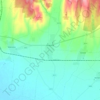
Nom : Carte topographique Čečejovce, altitude, relief.
Altitude moyenne : 217 m
Altitude minimum : 186 m
Altitude maximum : 303 m
The village lies at an altitude of 205 metres and covers an area of 24.527 km2. The village is located 22 kilometres from Košice.
Autres cartes topographiques
Cliquez sur une carte pour visualiser sa topographie, son altitude et son relief.
Kechnec
Slovakia > Region of Košice > District of Košice - okolie
Kechnec, District of Košice - okolie, Region of Košice, Eastern Slovakia, Slovakia
Altitude moyenne : 188 m