
Carte topographique Stella Maris
Carte interactive
Cliquez sur la carte pour afficher l’altitude.
À propos de cette carte
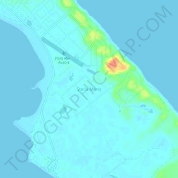
Nom : Carte topographique Stella Maris, altitude, relief.
Lieu : Stella Maris, Long Island, The Bahamas (23.55473 -75.28222 23.59473 -75.24222)
Altitude moyenne : 4 m
Altitude minimum : -1 m
Altitude maximum : 45 m
Autres cartes topographiques
Cliquez sur une carte pour visualiser sa topographie, son altitude et son relief.