
Carte topographique Rungwe
Carte interactive
Cliquez sur la carte pour afficher l’altitude.
À propos de cette carte
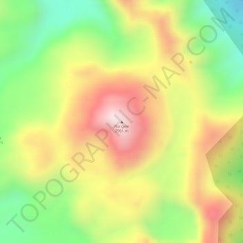
Nom : Carte topographique Rungwe, altitude, relief.
Lieu : Rungwe, Mbeya, Southern Highlands Zone, Tanzanie (-9.11767 33.66450 -9.11757 33.66460)
Altitude moyenne : 2 636 m
Altitude minimum : 2 371 m
Altitude maximum : 2 880 m
Autres cartes topographiques
Cliquez sur une carte pour visualiser sa topographie, son altitude et son relief.